Boundary areas and map
Map
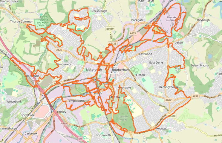
Areas included in the boundary map
| Area | Ward |
|---|---|
| Town Centre, Canklow, Templeborough, Broom Valley, Clifton and parts of Moorgate | Boston Castle |
| Deepdale, Broom and part of Whiston | Sitwell |
| Eastwood, East Dene, Clifton and Herringthorpe | Rotherham East |
| East Herringthorpe | Dalton and Thrybergh |
| Ferham, Holmes, Masbrough, Thornhill, Henley, Bradgate, Blackburn, Richmond Park and part of Kimberworth | Rotherham West |
| Part of Scholes, Kimberworth and Kimberworth Park | Keppel |
| Part of Greasbrough and Wingfield | Greasbrough |
| Aldwarke | Rawmarsh East |

