• Skip to content
  • Skip to navigation
Logo: Rotherham Metropolitan Borough Council
Your Account
  • Menu
Close menu
Close
  • About the Council
  • Business and Economy
  • Children and Families
  • Community and Living
  • Council Tax and Benefits
  • Education and Learning
  • Environment and Waste
  • Health and Social Care
  • Housing
  • Jobs and Careers
  • Leisure and Culture
  • Planning and Development
  • Transport and Streets
  • See all news
  • See all events
  1. Home
  2. Transport and streets
  3. Travel schemes
  4. Transforming Cities Fund (TCF) schemes

Transforming Cities Fund (TCF) schemes

In this section

  1. Transforming Cities Fund (TCF) schemes
  2. Parkgate link road and park & ride
  3. Magna Tram-train park and ride
  4. Frederick Street
  5. You are here: Maltby-Rotherham Bus Corridor
  6. Manvers to Wath cycle route (and Manvers Way footbridge)
  7. Rotherham to Tinsley walking and cycling route (Sheffield road cycleways)

Maltby-Rotherham Bus Corridor

Simple map highlighting the bus corridor location on the A631

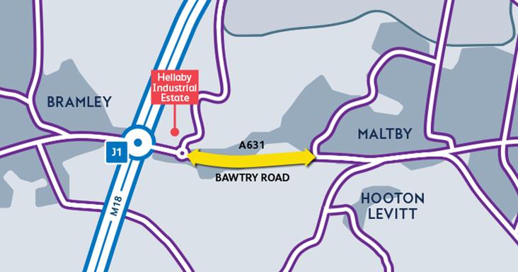
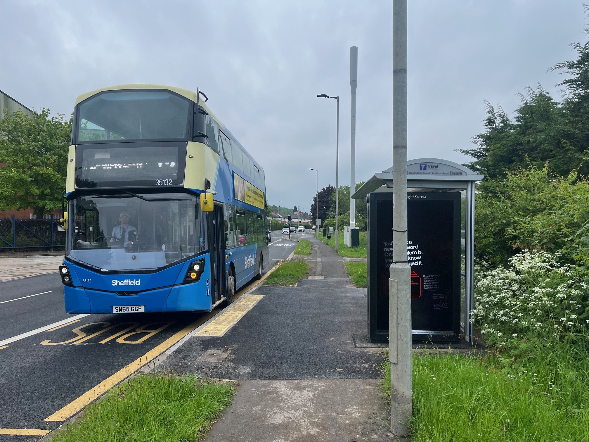
To improve public transport journey times and reliability, we have introduced an extra bus lane on sections of the A631 between Addison Road, Maltby, and the Bramley Roundabout/M18 Junction 1.

An additional bus lane runs between Addison Road, Maltby, and Denby Way, Hellaby, and there is an extension of the existing bus lane at Wickersley School towards the water works.

This provides residents, students, employees and businesses in and around the Maltby and Hellaby areas with faster and more reliable bus services, particularly the X1, X7 and X10 services linking Maltby to Rotherham and onwards to Sheffield City Centre via Magna and Meadowhall.

Work on the scheme is now substantially complete.

Public consultation took place in October/November 2022.

The scheme was delivered by Rotherham Council with money secured from the Department for Transport’s Transforming Cities Fund by the South Yorkshire Mayoral Combined Authority.

A bus pulling into a bus corridor on Harvest Close in Maltby.


Logos for Department for Transport and South Yorkshire Mayoral Combined Authority

Funded by uk Government logo

  • Previous page: Frederick Street
  • Next page: Manvers to Wath cycle route (and Manvers Way footbridge)

Stay connected

Sign up for our newsletter
Footer Logo: Rotherham Metropolitan Borough Council
  • About this website
  • Accessibility statement
  • Privacy
  • Languages
  • Contact Us
  • Location
  • Terms and conditions
  • Facebook logo
  • Twitter logo
  • YouTube logo
  • Instagram logo
  • LinkedIn logo

All content © 2025 Rotherham Metropolitan Borough Council. All Rights Reserved.

Designed and Powered by Jadu.

chatbot launch button image
Left Right
Full Wide Split Narrow
Chatbot avatar image
Hi, I'm Bailey
I'm here to answer your questions.

Hi, I'm Bailey, how can I help you today? You can ask me questions relating to a number of council services.

To start a chat you will need to click 'continue' to confirm you have read and understood our terms and conditions Privacy Policy.

Privacy Statement